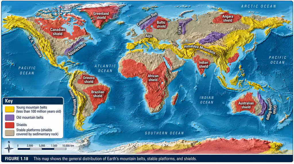
Question: “Geomorphology, although concerned primarily with present-day landscapes, attains its maximum usefulness by historical extension.” Comment.
Introduction: The Dual Identity of Geomorphology
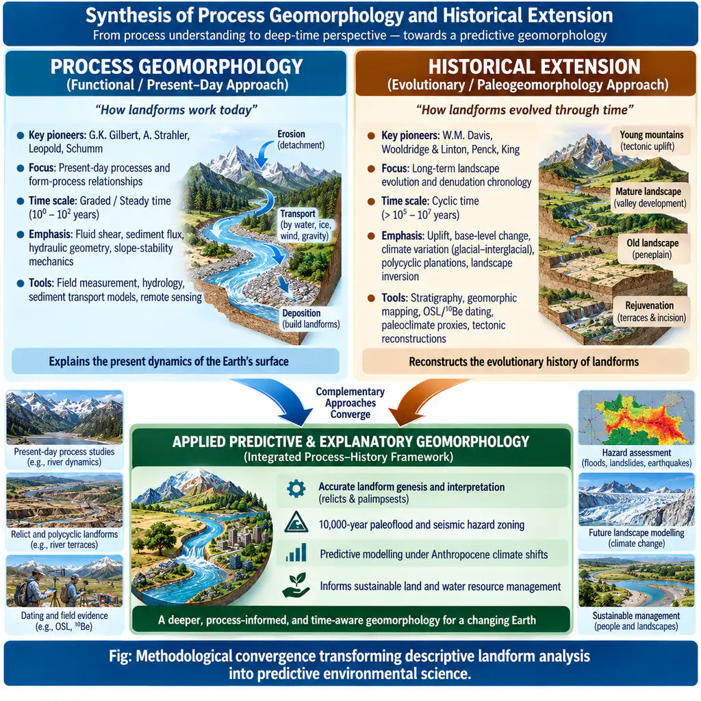
Geomorphology straddles two complementary paradigms: functional/process geomorphology (measuring contemporary mechanics, fluid shear, and sediment transfer; Gilbert, Strahler, Schumm) and historical geomorphology (reconstructing sequential landscape evolution across deep time; Hutton, Davis, Wooldridge & Linton). The statement argues that while modern geomorphologists meticulously document present processes, the discipline attains its greatest explanatory depth, diagnostic power, and applied utility through historical extension—tracing how inherited tectonic, climatic, and denudational pulses formed the modern surface.
1. Why Present-Day Landscapes Demand Historical Extension
A. The Preponderance of Palimpsest and Relict Landforms
Present-day surface processes (e.g., temperate fluvial regimes in Europe or semi-arid weathering in peninsular India) frequently operate on landforms inherited from radically different past morphogenetic regimes:
- Pleistocene Glacial Imprints: U-shaped valleys, hanging valleys, and cirques across the Scottish Highlands or Kashmir Himalayas (e.g., Lidder valley) cannot be formed by the modest streams currently occupying them; they represent underfit streams flowing through fossil glacial troughs.
- Paleo-Arid Dune Fields: In the Haryana-Punjab plains and Thar margins, stabilized longitudinal fossil sand dunes formed during the hyper-arid Last Glacial Maximum (LGM ~21 ka) are now farmed under humid monsoon regimes.
- Karst Dry Valleys: Dry chalk/limestone valleys in southern England and European plateaux reflect permafrost conditions during Pleistocene stadials that temporarily rendered the rock impermeable to surface runoff.
B. Decoding Polycyclic Topography and Denudation Chronology
Topography rarely reflects a single uninterrupted cycle of erosion:
- Polycyclic Surfaces of Chotanagpur: Stepped planation surfaces—the western high Pats (~1,000 m), the Ranchi Plateau (~650 m), and the lower Purulia/Manbhum plains (~300 m)—record successive pulses of uplift related to the Tertiary Himalayan collision separated by periods of partial planation. Without historical extension, these stepped terraces would be erroneously ascribed to local structural lithologies.
- Indo-Gangetic Basin Stacking: The immense alluvium (~4,000–6,000 m thick) and intermontane valley fills (Kashmir Karewas) encode 2.5 million years of tectonic pulses, glacio-fluvial outbursts, and monsoonal shifts.
2. Practical and Applied Significance of Historical Extension
- Paleohydrology and Extreme Hazard Risk Modeling:
- Modern stream gauging records rarely exceed 50–100 years. Historical extension through Slackwater Deposits (SWD) and slackwater paleoflood hydrology allows reconstruction of 1,000-year to 10,000-year Maximum Credible Floods (MCF) on rivers like the Narmada, Krishna, and Teesta, which is vital for civil dam safety (e.g., Sardar Sarovar, Tehri Dam).
- Paleoseismology and Infrastructure Alignment:
- Investigating faulted alluvial terraces, trenching across the Main Frontal Thrust (MFT), and dating paleolake breaches (e.g., ancient landslide-dammed lake outbursts in the Alaknanda/Sutlej basins) are mandatory to assess return periods for Himalayan mega-earthquakes (> M8.0).
- Palaeo-placer and Mineral Exploration:
- Economic mineral concentrations (e.g., gold and diamondiferous gravels in Panna, beach heavy-mineral placers in Kerala/Odisha) are ancient sedimentary lag concentrates governed by paleo-drainage channels that can only be found via historical geomorphological mapping.
Conclusion
As Schumm and Lichty (1965) demonstrated in their space-time relativity framework, what appears as an independent, immutable structural control in present-day “graded time” is revealed as a dependent, evolving product in “cyclic time.” Present-day processes explain the mechanics of form, but historical extension reveals the trajectory of landscape evolution, conferring the ultimate predictive utility required in an era of Anthropocene climate disruption.