Brahmaputra River System
- The Brahmaputra (meaning the son of Brahma).
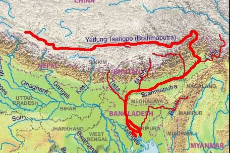
- The Brahmaputra’s source is the Chemayungdung glacier in southwestern Tibet. It’s source is very close to the sources of Indus and Satluj.
- Mariam La separates the source of the Brahmaputra from the Manasarovar Lake.
- In Tibet, it passes through the depression formed by the Indus-Tsangpo Structure Zone between the Great Himalayas in the south and the Kailas Range in the north.
- Inspite of the exceptionally high altitude, the Tsangpo has a gentle slope. The river is sluggish and has a wide navigable channel for about 640 km.
- It receives a large number of tributaries in Tibet. The first major tributary is the Raga Tsangpo meeting the Tsangpo near Lhatse Dzong.
- It flows as the Yarlung Tsangpo River across southern Tibet to break through the Himalayas in great gorges and into Arunachal Pradesh where it is known as Dihang.
- Just west of the town of Sadiya, the Dihang turns to the southwest and is joined by two mountain streams, the Lohit and the Dibang.
- Below the confluence, the river is known as the Brahmaputra.
- It flows through Bangladesh as the Jamuna where it merges with the Ganga to form a vast delta, the Sunderbans.
- The biggest and the smallest river islands in the world, Majuli, and Umananda respectively, are in the river in the state of Assam.
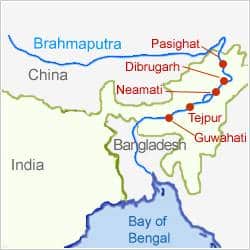
- Dibrugarh, Pasighat, Neamati, Tezpur, and Guwahati are the important urban centers on the river.
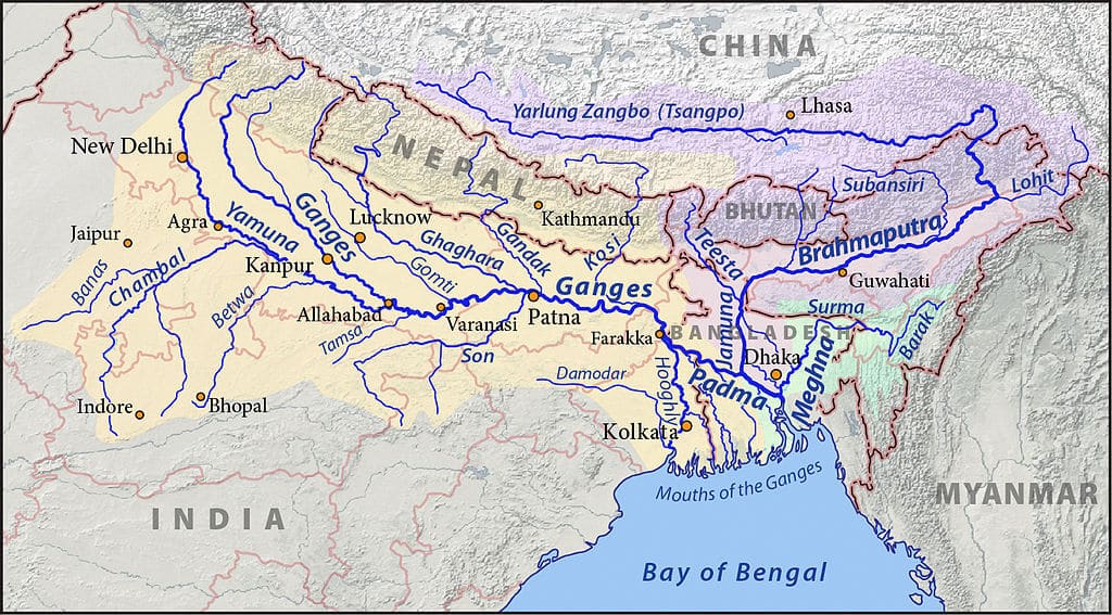
| Region | Name |
| Tibet | Tsangpo (meaning ‘The Purifier’) |
| China | Yarlung Zangbo Jiangin |
| Assam Valley | Dihang or Siong, South of Sadiya: Brahmaputra |
| Bangladesh | Jamuna River |
| Bangladesh | Padma River: Combined Waters of Ganga and Brahmaputra |
| Bangladesh | Meghana: From the confluence of Padma and Meghna |
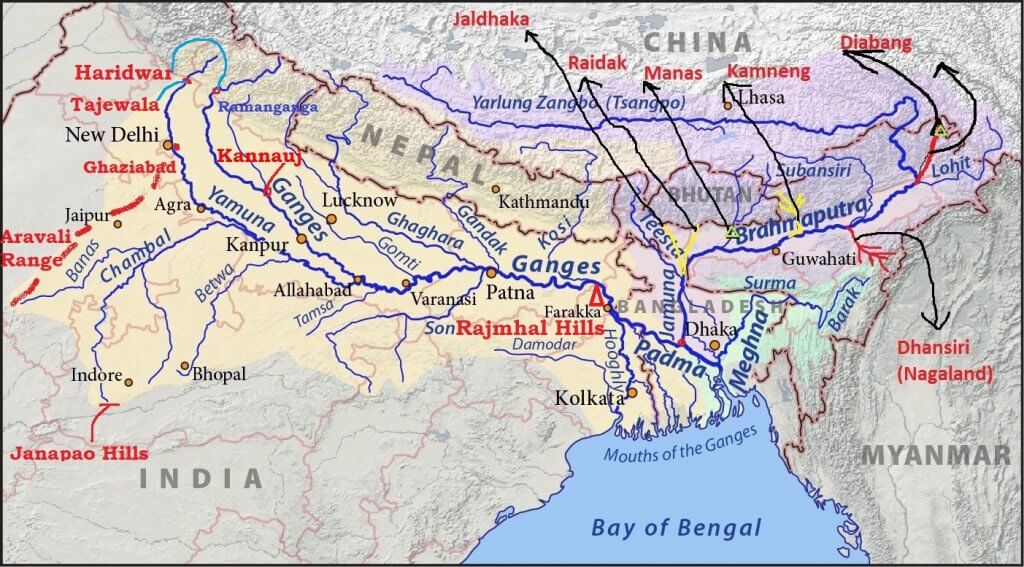
Major Tributaries of the Brahmaputra River
Left bank – Dhansiri, Lohit, Dibang
Right Bank – Subansiri, Kameng, Manas, Sankosh

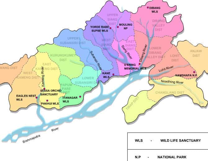
Subansiri River
- Subansiri River is also called as Gold River as it is famous for its gold dust.
- It flows through the Lower Subansiri District in Arunachal Pradesh.
- Subansari, a swift river offers excellent kayaking opportunities.
Kameng River
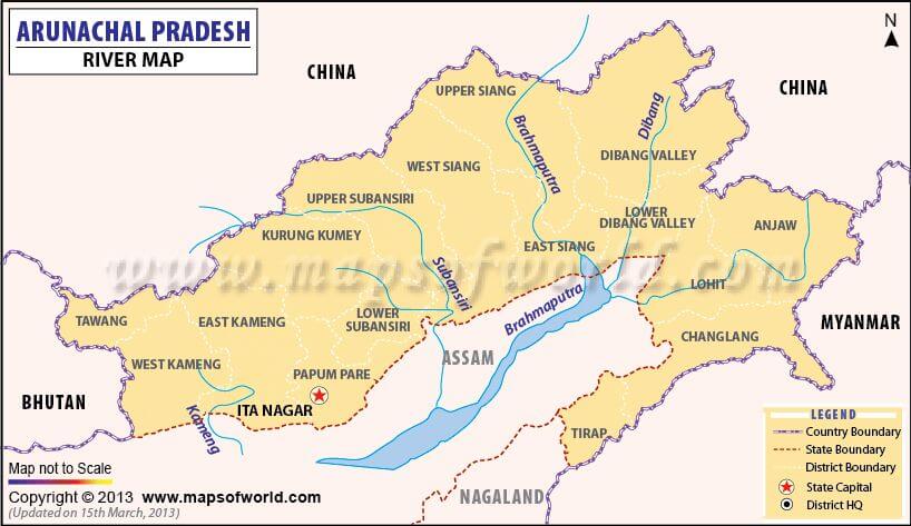
- Kameng River in the eastern Himalayan mountains originates in the Tawang district
- Flows through West Kameng District, Arunachal Pradesh, and Sonitpur District of Assam.
- The Kameng forms the boundary between East Kameng District and West Kameng Districts.
- The Pakhui Wildlife Sanctuary and the Kaziranga National Park are located near the Kameng River.
Manas River
- Manas River is a transboundary river in the Himalayan foothills between southern Bhutan and India.
- The total length of the river is 376 km, flows through Bhutan for 272 km and then through Assam for 104 km before it joins the mighty Brahmaputra River at Jogighopa
- The river valley has two major reserve forest areas, namely the Royal Manas National Park in Bhutan and the contiguous Manas Wildlife Sanctuary.
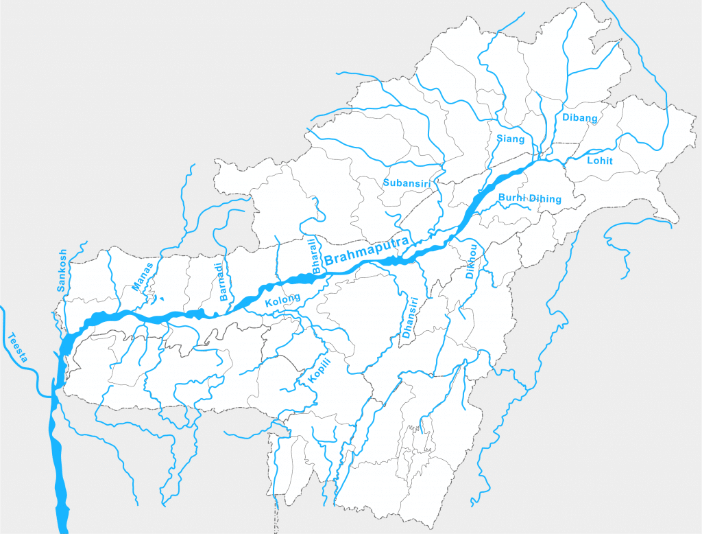
Sankosh River
- It rises in northern Bhutan and empties into the Brahmaputra in the state of Assam
- The upper catchment of the river is glaciated. The middle and the lower courses flow along V-shaped valleys that have been carved by running water
- The entire catchment of the river is covered with forests.
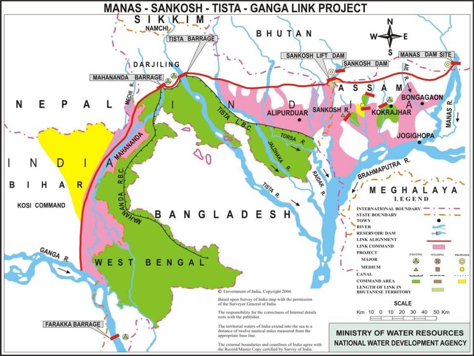
Teesta River
- The river originates from Tso Lhamo lake in North Sikkim at an elevation of 5330 m in the Himalayas.
- Rangeet River is the major tributary of the Teesta River. Rangeet river is the largest river in Sikkim. Rangeet river joins Teesta river at a place known as Tribeni.
- The river then flows past the town of Rangpo where it forms the border between Sikkim and West Bengal up to Teesta Bazaar.
- The river flows through Jalpaiguri and then to Rangpur District of Bangladesh, before finally merging with the mighty Brahmaputra.
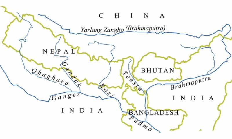
Dibang River
- The river Dibang is one of the principal tributaries of the Brahmaputra river
- Originating from the snow-covered southern flank of the Himalayas close to the Tibet border at an altitude of more than 5000 m.
- It emerges from the hills to enter the plain area near Nizamghat in the Lower Dibang Valley district of Arunachal Pradesh
- The Mishmi hills are found along the upper course of the Dibang River.
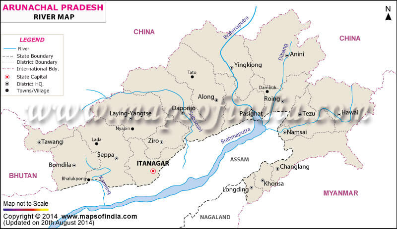
Lohit River
- The River Lohit originates in eastern Tibet.
- The river flows through the Mishmi hills to meet the Siang at the head of Brahmaputra valley
- The valley of Lohit is thickly forested, covered with alpine and sub-tropical vegetation
- A large variety of medicinal plants are also found here.
Dhansiri River
- It is the main river of Golaghat District of Assam and Dimapur District of Nagaland
- It originates from Nagaland
- There are numerous perennially waterlogged swampy regions associated with this river.
Kopili River
- Kopili River is an interstate river in Northeast India that flows through the states of Meghalaya and Assam and is the largest south bank tributary of the Brahmaputra in Assam.
- Carissa Kopilii (Plant Species) is distributed sparsely along the Kopili riverbed. The plant is threatened by a hydroelectric project on the river and water turned acidic because of coal mining in Meghalaya upstream.
Siyom River
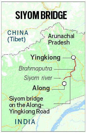
- The Siyom River is a right tributary of the Brahmaputra.
- Siyom rises on the south of the main ridge of the Assam Himalaya not far from the border with Tibet.
- The Mouling National Park is located on the east bank of the river.
- The Siyom initially flows in a southerly direction, later in an easterly and southerly direction through the West Siang District. The Saje River is the most prominent of its several tributaries.
- Siyom Bridge:
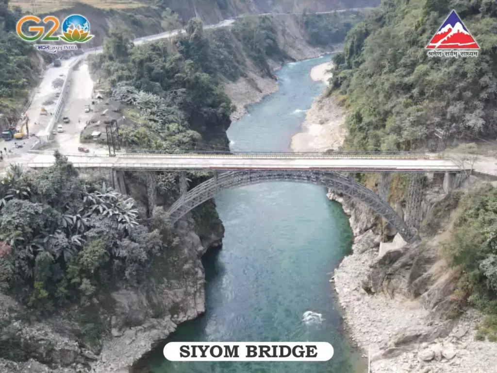
- The Siyom Bridge is a state-of-the-art 100-meter long, Class 70 Steel Arch Superstructure over Siyom River in Arunachal Pradesh.
- Siyom Bridge has a great Strategic Significance to tackle China as it is a gateway to sensitive areas of LAC in Arunachal Pradesh.
Important cities on Brahmaputra
Major River Valley Projects/Dams/Barrages associated with the Brahmaputra river system-
In the state of Arunachal Pradesh-
- Tawang Hydel Power Project
- Subansiri Lower Hydel Power Project
- Ranganadi Hydel Power Project
- Paki Hydel Power Project
- Papumpap Hydel Power Project
- Dhinkrong Hydel Power Project
- Upper Lohit Hydel Power Project
- Damway Hydel Power Project
- Kameng Hydel Power Project
In the state of Sikkim-
- Rangit Hydel Power Project
- Teesta Hydel Power Project
In the state of Assam-
- Kopli Hydel Power Project
In the state of Meghalaya-
- New Umtru Hydel Power Project
In the state of Nagaland-
- Doyang Hydel Power Project
In the state of Manipur-
- Loktak Hydel Power Project
- Tipaimukh Hydel Power Project
In the state of Mizoram-
- Tuibai Hydel Power Project
- Tuirial Hydel Power Project
- Dhaleshwari Hydel Power Project
[amazon box=”B08B8PRDHC”]

Very very helpful 😍😍😍😍😍🥰🥰🥰 amazing superb content . I have no words to appreciate it. 🤗🤗🤗🤗🤗🤗😍😍😍🥰🥰🥰
Outstanding work done by you sir…as usual.
Thank you so much for providing these for free.🙏🙏
Most helpful site organised by lotusarise,it is more beneficial for NCERT understanding and upsc advance classes if you have done this , you are able to solve the 60-70percent questions of geography.
nailed it , the whole illustration both pictorial and theory written.. it is good in content moreover, amused while reading