
Q. Consider the following statements :
- Jhelum River passes through Wular Lake.
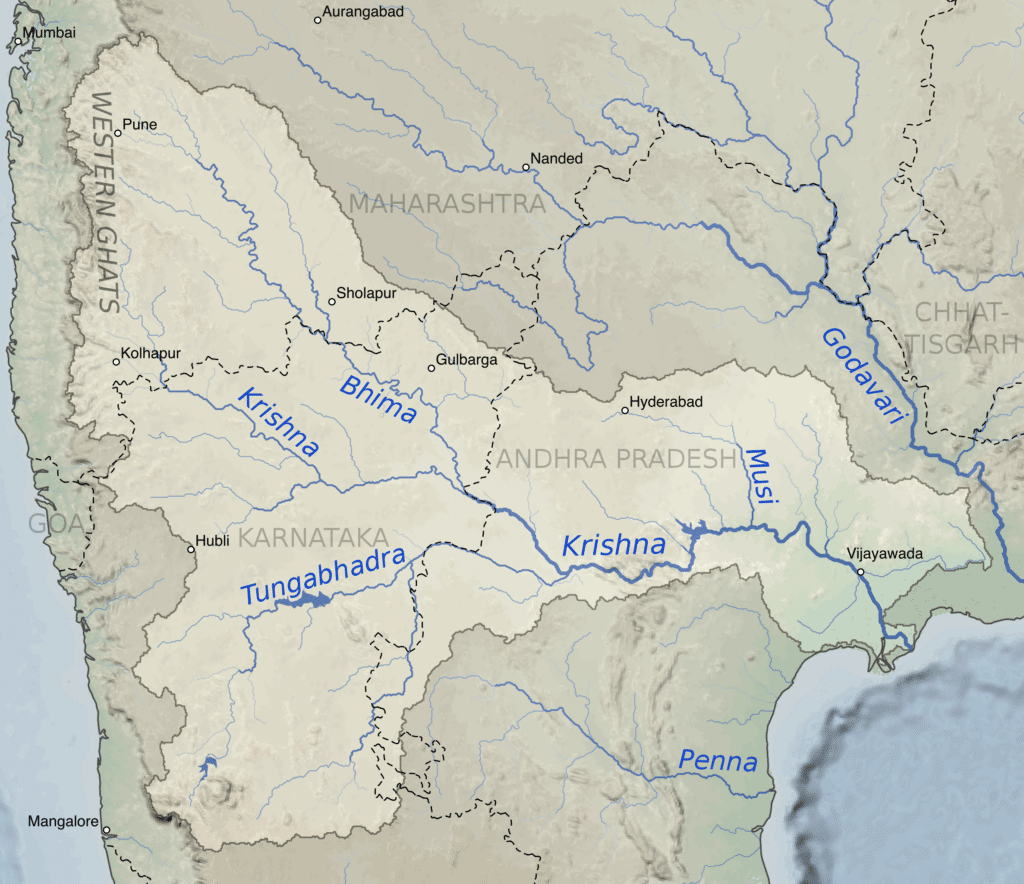
- Krishna River directly feeds Kolleru Lake.
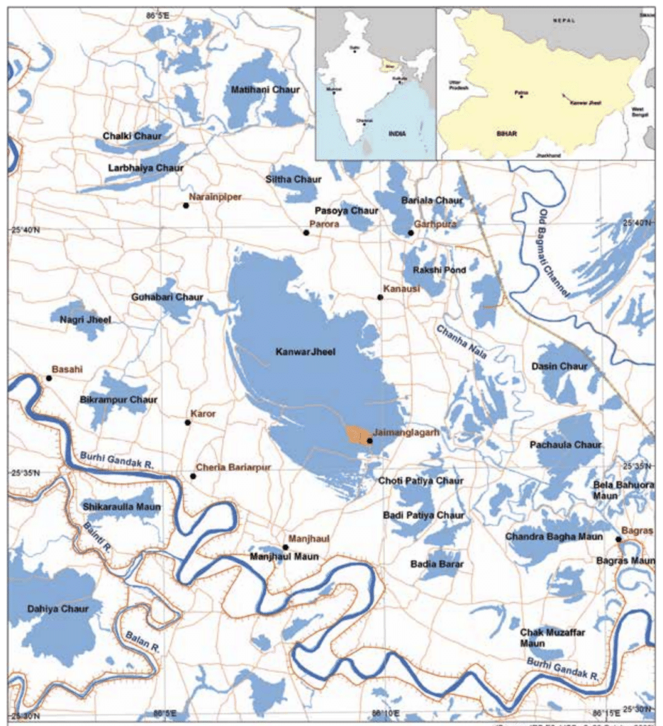
- Meandering of Gandak River formed Kanwar Lake.
How many of the statements given above are correct?
- Only one
- Only two
- All three
- None
Answer: (a) Only one
Jhelum River
- The Jhelum River flows from the Indian union territory of Jammu and Kashmir into Pakistani Punjab, passing through the Pakistani-administered territory of Azad Kashmir.
- It is the westernmost of the Punjab region’s five rivers, and it flows through the Kashmir Valley.
- It is a Chenab River tributary with a total length of about 725 kilometres.
- The Jhelum originates at Vernag, in western Jammu and Kashmir union territory, in the Indian-administered portion of the Kashmir region, from a deep spring.
- The river flows northwestward from the Pir Panjal Range’s northern slope through the Vale of Kashmir to Srinagar’s Wular Lake, which regulates its flow. The Jhelum emerges from the lake and flows westward, cutting through the Pir Panjal in a gorge that is 7,000 feet (2,100 metres) deep and has almost perpendicular sides.
- The Jhelum River receives the Kishanganga River at Muzaffarabad, the administrative centre of Azad Kashmir in the Pakistani-administered sector of Kashmir, and then bends southward, forming part of the border between Azad Kashmir to the east and Khyber Pakhtunkhwa province, Pakistan, to the west.
- The river then flows into Punjab province to the south. The Jhelum River breaks through the Outer Himalayas near Mangla, forming broad alluvial plains. The river turns southwestward at Jhelum, following the Salt Range to Khushab, where it bends south again to join the Chenab River near Trimmu.
- The Jhelum is about 450 miles long in total (725 km). Up to the Line of Control (LOC), where it enters Pakistan, the total catchment area is about 15,856 km2.
- DAMS
- With a storage capacity of 5,900,000 acre-feet, the Mangla Dam, completed in 1967, is huge earth-fill dams.
- The Rasul Barrage, built in 1967, has a maximum flow of 850,000 feet per second.
- The Trimmu Barrage, built in 1939 near Jhang Sadar at the Chenab’s confluence, has a maximum discharge capacity of 645,000 ft3/s.
- Victoria Bridge (Haranpur) was built in 1933. Near Chak Nizam Village, about 5 kilometres from Malakwal. It has a length of one kilometre and is primarily used by Pakistan Railways.
- The Uri Dam, which has a 480 MW hydroelectric station, is located in Jammu and Kashmir’s Baramulla district.
- The Uri Dam II, which has a 240 MW hydroelectric station, is also in Jammu and Kashmir’s Baramulla district.
- Kishanganga Hydroelectric Plant is a 330 MW hydroelectric station in Jammu and Kashmir’s Bandipora district.

Krishna River
- The Krishna River is a river in the Deccan plateau and is the third-longest river in India, after the Ganges and Godavari.
- It is also the fourth-largest in terms of water inflows and river basin area in India, after the Ganges, Indus and Godavari.
- The river, also called Krishnaveni, it is 1,400 kilometres (870 mi) long and its length in Maharashtra is 282 kilometres.
- It is a major source of irrigation in the Indian states of Maharashtra, Karnataka, Telangana and Andhra Pradesh.
- The Krishna River originates in the Western Ghats near Mahabaleshwar at an elevation of about 1,300 metres (4,300 ft), in the state of Maharashtra in central India. From Mahabaleshwar it flows to the town of Wai and continues to travel east until it empties into the Bay of Bengal.
- The Krishna River has 13 major tributaries. Its principal tributaries include the Ghataprabha River, Malaprabha River, Bhima River, Tungabhadra River and Musi River.
- The Bhima River is the longest tributary of the Krishna River.
- Three tributaries Panchganga, Warna and Yerla meet Krishna river near Sangli. These places are considered very holy.
- It is said that Lord Dattatreya spent some of his days at Audumber on the banks of river Krishna.
- Waterfalls
- Ethipothala on Chandravanka river which is the tributary of river Krishna river.
- Godchinamalaki on Markandeya river a tributary of Ghataprabha.
- Gokak on Ghataprabha in Belagavi district of Karnataka.
- Mallela Theertham on Krishna River in the Nallamala Forest in Nagarkurnool, Telangana.
- Dams
- Nagarjunasagar Dam
- Srisailam Dam
- Almatti Dam
- Tungabhadra Dam
- Dhom Dam
- The Kolleru lake serves as a natural flood-balancing reservoir for two rivers. The lake is fed directly by water from the seasonal Budameru and Tammileru streams. It is connected to the Krishna (but not directly feeds) and Godavari systems by over 68 inflowing drains and channels.
Kanwar Lake
- The Kanwar Taal or Kabar Taal Lake or Kabartal Wetland located in Begusarai district of Bihar, India, is Asia’s largest freshwater oxbow lake.
- It is the first Ramsar site in Bihar.
- It is a residual oxbow lake, formed due to meandering of Burhi Gandak river, a tributary of Ganga, in the geological past.
- Once a haven for migratory birds, the Kanwar lake in Bihar, Asia’s largest freshwater oxbow lake, is today a dying wetland ecosystem.
- Kanwar Lake was declared a notified area under the Wildlife (Protection) Act of 1972.